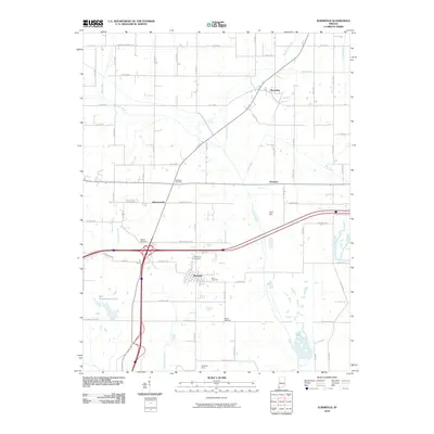
2010 Map of Elberfeld
USGS Topo · Published 2010About this map
Elberfeld serves as the primary hub in this southern Indiana landscape, where the local economy and geography are defined by the Elberfeld Mine and a network of rural settlements. The area is marked by a significant density of family and community burial grounds, including Williams Cemetery, Nobles Cemetery, and Susett Cemetery, which offer valuable coordinates for genealogical research. Waterways like Pigeon Creek and Bluegrass Creek wind through the terrain, with Lost Hill providing a rare named elevation point in the region. To the west, Bell Conservation Lake stands out as a prominent water feature, while smaller hamlets like Buckskin, Rosebud, and Wheatonville are connected by a grid of county roads such as Wheatonville Rd and Seven Hills Rd. This survey documents the intersection of modern infrastructure with long-established rural landmarks at the start of the 2010s.
Find a feature on this map
45 named features on this map. Tap any name to fly to it.
Don’t see what you’re looking for? This feature index may not catch every label — zoom into the map to look around manually.
Map Details
Editions of this 2010 Elberfeld Map
This is the sole edition of this map. No revisions or reprints were ever made.
Other maps of this area

1901 · Princeton
USGS Topo · 1:62,500

1901 · Haubstadt
USGS Topo · 1:62,500

1902 · Ditney
USGS Topo · 1:125,000

1902 · Boonville
USGS Topo · 1:62,500

1903 · Haubstadt
USGS Topo · 1:62,500

1903 · Petersburg
USGS Topo · 1:62,500

1903 · Princeton
USGS Topo · 1:62,500

1903 · Patoka
USGS Topo · 1:125,000

1956 · Vincennes
USGS Topo · 1:250,000

1957 · Vincennes
USGS Topo · 1:250,000