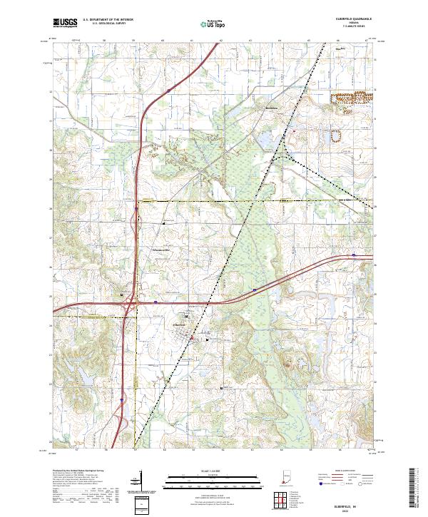
2022 Map of Elberfeld
USGS Topo · Published 2022About this map
Elberfeld and its surrounding tri-county borders serve as a focal point for this survey of southwestern Indiana. The landscape is defined by the legacy of the historic Wabash and Erie Canal, which cuts through the lowlands north of town, and the meandering course of Pigeon Creek. This area, where Gibson, Warrick, and Vanderburgh counties meet, shows a pattern of rural settlement and agriculture punctuated by small communities like Buckskin and Wheatonville. Local genealogy is well-documented through several family and community burial grounds, including Williams Cem, Nobles Cem, and Zion Cem. Notable water features such as Bell Conservation Lake and Warrens Lake highlight the region's managed water resources, while the transition from the Snake Run valley to the heights of Lost Hill illustrates the varied local topography.
Find a feature on this map
102 named features on this map. Tap any name to fly to it.
Don’t see what you’re looking for? This feature index may not catch every label — zoom into the map to look around manually.
Map Details
Editions of this 2022 Elberfeld Map
This is the sole edition of this map. No revisions or reprints were ever made.
Other maps of this area

1901 · Princeton
USGS Topo · 1:62,500

1901 · Haubstadt
USGS Topo · 1:62,500

1902 · Ditney
USGS Topo · 1:125,000

1902 · Boonville
USGS Topo · 1:62,500

1903 · Haubstadt
USGS Topo · 1:62,500

1903 · Petersburg
USGS Topo · 1:62,500

1903 · Princeton
USGS Topo · 1:62,500

1903 · Patoka
USGS Topo · 1:125,000

1956 · Vincennes
USGS Topo · 1:250,000

1957 · Vincennes
USGS Topo · 1:250,000