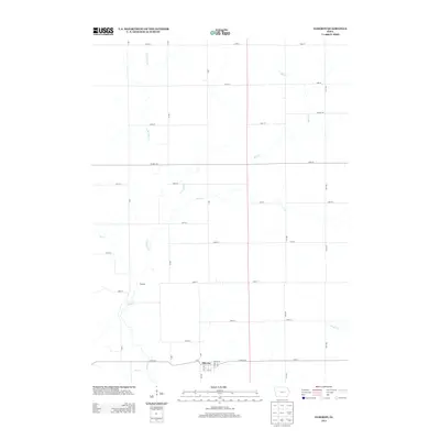
2013 Map of Elberon
USGS Topo · Published 2013About this map
Elberon sits at the southern edge of this Tama County landscape, defined by a grid of rural roads and a complex network of waterways. The settlement's street plan, featuring Railway St and 1st St, suggests a history tied to the regional transportation network, while the small community of Waltham lies to the northwest along the winding banks of Salt Cr. The surrounding terrain is heavily influenced by the drainage patterns of the E Br Salt Cr, Stein Cr, and Wolf Cr, which create the natural breaks in the otherwise structured agricultural sections. This survey captures the rural character of the region as it appeared in the early 21st century, with thoroughfares like Co Hwy-E44 and Co Hwy-E36 providing the primary east-west connections between these Iowa prairie settlements.
Find a feature on this map
42 named features on this map. Tap any name to fly to it.
Don’t see what you’re looking for? This feature index may not catch every label — zoom into the map to look around manually.
Map Details
Editions of this 2013 Elberon Map
This is the sole edition of this map. No revisions or reprints were ever made.
Other maps of this area

1954 · Waterloo
USGS Topo · 1:250,000

1954 · Des Moines
USGS Topo · 1:250,000

1955 · Waterloo
USGS Topo · 1:250,000

1956 · Des Moines
USGS Topo · 1:250,000

1957 · Des Moines
USGS Topo · 1:250,000

1965 · Keystone South
USGS Topo · 1:24,000

1968 · Belle Plaine
USGS Topo · 1:24,000

1968 · Chelsea
USGS Topo · 1:24,000

1969 · Des Moines
USGS Topo · 1:250,000
1971 · Elberon
USGS Topo · 1:24,000