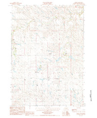
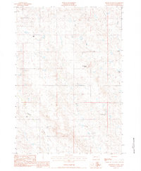
1983 Map of Elbon
USGS Topo · Published 1984About this map
Elbon and its surrounding ranchlands characterize this portion of Haakon County during the early 1980s. The landscape is defined by a network of family-operated holdings, such as the Kroetch Ranch, Donald King Ranch, and Rick King Ranch, which reflect the region's enduring agricultural identity. The small settlement of Elbon serves as a local focal point, featuring the Elbon Sch and providing a sense of community for the dispersed population.
Find a feature on this map
14 named features on this map. Tap any name to fly to it.
Don’t see what you’re looking for? This feature index may not catch every label — zoom into the map to look around manually.
Map Details
Editions of this 1983 Elbon Map
This is the sole edition of this map. No revisions or reprints were ever made.
Other maps of this area

1954 · Pierre
USGS Topo · 1:250,000

1958 · Pierre
USGS Topo · 1:250,000

1983 · Philip
USGS Topo · 1:100,000

1983 · Hilland
USGS Topo · 1:24,000
1983 · Elevenmile Corner
USGS Topo · 1:24,000
1983 · Hartley
USGS Topo · 1:24,000

1983 · Milesville
USGS Topo · 1:24,000

1983 · Tornado Ranch
USGS Topo · 1:24,000
1983 · Lucerne
USGS Topo · 1:24,000
1983 · Grindstone Butte
USGS Topo · 1:24,000