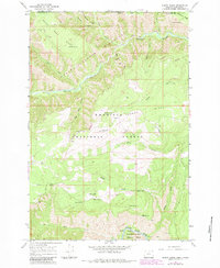
1967 Map of Elbow Creek
USGS Topo · Published 1983About this map
Wenaha River and Grande Ronde River dominate this remote landscape along the border of Washington and Oregon. Mapped in the mid-1960s with 1980s updates, the region is defined by its deep canyons and high ridges, including Grizzly Bear Ridge and Hoodoo Ridge. The survey meticulously documents the network of water sources essential for this high-country environment, such as Huntit Spring, Mosier Spring, and Thorn Springs. Much of the territory falls within the Umatilla National Forest and the Wallowa-Whitman National Forest, with a significant portion dedicated to the Wenaha-Tucannon Wilderness. Access is limited to trails and unimproved roads, with the Wenaha River Trail following the waterway through the heart of the canyon. Notable landmarks like Squaw Falls and Round Meadow provide specific points of reference in this densely forested and deeply incised terrain.
Find a feature on this map
35 named features on this map. Tap any name to fly to it.
Don’t see what you’re looking for? This feature index may not catch every label — zoom into the map to look around manually.
Map Details
Editions of this 1967 Elbow Creek Map
3 editions found
Other maps of this area

1937 · Pomeroy
USGS Topo · 1:96,000

1942 · Pomeroy
USGS Topo · 1:125,000

1955 · Pullman
USGS Topo · 1:250,000

1955 · Grangeville
USGS Topo · 1:250,000

1958 · Pullman
USGS Topo · 1:250,000

1959 · Grangeville
USGS Topo · 1:250,000

1967 · Fry Meadow
USGS Topo · 1:24,000

1967 · Eden
USGS Topo · 1:24,000

1967 · Elbow Creek
USGS Topo · 1:24,000

1967 · Oregon Butte
USGS Topo · 1:24,000