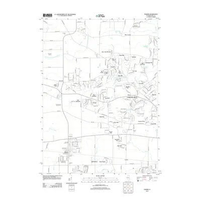
2012 Map of Elburn
USGS Topo · Published 2012About this map
Elburn and Campton Hills anchor this 2012 study of the Kane County landscape, where the shifting boundary between residential development and prairie agricultural land is clearly visible. The region is defined by a dense network of suburban clusters such as Silver Glen Meadows, Fair Oaks, and Foxfield, many established on land once dominated by large farmsteads. Significant water features like the East Branch South Branch Kishwaukee River and Blackberry Cr wind through the terrain, while the man-made Virgil Ditch Number 1 indicates the historical efforts to manage the area's hydrology. For genealogists, the map is particularly valuable for its documentation of several pioneer-era burial grounds, including the New Hampshire Settlement Cem and the Garfield Farm Cem. Transport remains centered on regional arteries like Burlington Rd and the small aviation hub at Aeroview Airport.
Find a feature on this map
229 named features on this map. Tap any name to fly to it.
Don’t see what you’re looking for? This feature index may not catch every label — zoom into the map to look around manually.
Map Details
Editions of this 2012 Elburn Map
This is the sole edition of this map. No revisions or reprints were ever made.
Other maps of this area

1925 · Elgin
USGS Topo · 1:62,500

1932 · Geneva
USGS Topo · 1:62,500

1937 · Sycamore
USGS Topo · 1:62,500

1938 · Genoa
USGS Topo · 1:62,500

1940 · Elgin
USGS Topo · 1:62,500

1948 · Geneva
USGS Topo · 1:62,500

1949 · Geneva
USGS Topo · 1:24,000

1950 · Aurora North
USGS Topo · 1:24,000

1954 · Rockford
USGS Topo · 1:250,000

1955 · Rockford
USGS Topo · 1:250,000