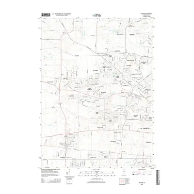
2015 Map of Elburn
USGS Topo · Published 2015About this map
Campton Hills and its surrounding residential developments characterize this central Kane County landscape, where modern suburban expansion meets deep-rooted local history. The map highlights numerous burial grounds that serve as touchstones for genealogists, including the New Hampshire Settlement Cem and the Saint Gall Catholic Cem. Small settlements and distinct neighborhoods like Wasco and Plato Corners are situated among a network of tributaries such as Stony Cr and Blackberry Cr. The presence of several family-named landmarks, like the L R Baker Cem, points to the agricultural families who established the area before it became part of the westward growth from Elgin. The terrain is marked by pockets of water like Horseshoe Lake and Turtle Rock Lake, integrated into the contemporary township structure.
Find a feature on this map
213 named features on this map. Tap any name to fly to it.
Don’t see what you’re looking for? This feature index may not catch every label — zoom into the map to look around manually.
Map Details
Editions of this 2015 Elburn Map
This is the sole edition of this map. No revisions or reprints were ever made.
Other maps of this area

1925 · Elgin
USGS Topo · 1:62,500

1932 · Geneva
USGS Topo · 1:62,500

1937 · Sycamore
USGS Topo · 1:62,500

1938 · Genoa
USGS Topo · 1:62,500

1940 · Elgin
USGS Topo · 1:62,500

1948 · Geneva
USGS Topo · 1:62,500

1949 · Geneva
USGS Topo · 1:24,000

1950 · Aurora North
USGS Topo · 1:24,000

1954 · Rockford
USGS Topo · 1:250,000

1955 · Rockford
USGS Topo · 1:250,000