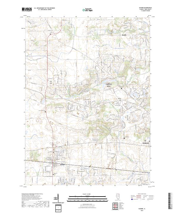
2024 Map of Elburn
USGS Topo · Published 2024About this map
Blackberry Creek and Mill Creek carve through this landscape of the Fox River Valley, documenting the modern character of western Kane County. The map highlights the village of Elburn and the residential clusters of Campton Hills and Wasco, where suburban growth meets the persistent agricultural grid of the Illinois prairie. For genealogists, the survey is particularly detailed, recording numerous small burial grounds including Saint Gall Cem, Blackberry Cem, and the L. M. Baker Cem.
Find a feature on this map
189 named features on this map. Tap any name to fly to it.
Don’t see what you’re looking for? This feature index may not catch every label — zoom into the map to look around manually.
Map Details
Editions of this 2024 Elburn Map
This is the sole edition of this map. No revisions or reprints were ever made.
Other maps of this area

1925 · Elgin
USGS Topo · 1:62,500

1932 · Geneva
USGS Topo · 1:62,500

1937 · Sycamore
USGS Topo · 1:62,500

1938 · Genoa
USGS Topo · 1:62,500

1940 · Elgin
USGS Topo · 1:62,500

1948 · Geneva
USGS Topo · 1:62,500

1949 · Geneva
USGS Topo · 1:24,000

1950 · Aurora North
USGS Topo · 1:24,000

1954 · Rockford
USGS Topo · 1:250,000

1955 · Rockford
USGS Topo · 1:250,000