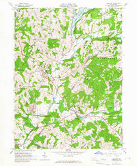
1964 Map of Elderton
USGS Topo · Published 1966About this map
The borough of Elderton serves as a central hub on this mid-1960s survey, where the township boundaries of Plum Creek, Washington, and South Bend converge. The landscape is defined by the winding course of Crooked Creek and the recently developed Plum Creek Reservoir, which altered the northern terrain. This era shows an active extraction economy, with several Gas Fields and Strip Mine operations scattered among the ridge lines and valleys like Dark Hollow Run.
Find a feature on this map
43 named features on this map. Tap any name to fly to it.
Don’t see what you’re looking for? This feature index may not catch every label — zoom into the map to look around manually.
Map Details
Editions of this 1964 Elderton Map
3 editions found
Other maps of this area

1901 · Rural Valley
USGS Topo · 1:62,500

1902 · Indiana
USGS Topo · 1:62,500

1902 · Elders Ridge
USGS Topo · 1:62,500

1903 · Rural Valley
USGS Topo · 1:62,500

1904 · Elders Ridge
USGS Topo · 1:62,500

1909 · Smicksburg
USGS Topo · 1:62,500

1938 · Smicksburg
USGS Topo · 1:62,500

1939 · Smicksburg
USGS Topo · 1:62,500

1953 · Pittsburgh
USGS Topo · 1:250,000

1954 · Pittsburgh
USGS Topo · 1:250,000