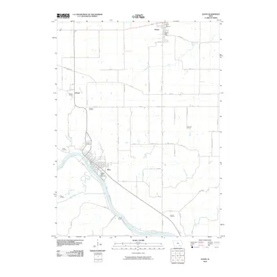
2010 Map of Eldon
USGS Topo · Published 2010About this map
The Des Moines River cuts a wide path through this corner of Wapello County, anchoring the settlement of Eldon along its eastern bank. The town plan is clearly defined by its street grid, featuring the Eldon Post Office and the Wapello County Fairgrounds at its southern edge. This riverfront landscape is characterized by its numerous small burial grounds and rural hubs, including the community of Batavia in the north and the crossroads of Ashland to the west.
Find a feature on this map
47 named features on this map. Tap any name to fly to it.
Don’t see what you’re looking for? This feature index may not catch every label — zoom into the map to look around manually.
Map Details
Editions of this 2010 Eldon Map
This is the sole edition of this map. No revisions or reprints were ever made.
Other maps of this area

1954 · Centerville
USGS Topo · 1:250,000

1954 · Des Moines
USGS Topo · 1:250,000

1956 · Des Moines
USGS Topo · 1:250,000

1956 · Farson
USGS Topo · 1:24,000

1956 · Agency
USGS Topo · 1:24,000

1956 · Ottumwa North
USGS Topo · 1:62,500

1956 · Ottumwa South
USGS Topo · 1:62,500

1957 · Des Moines
USGS Topo · 1:250,000

1957 · Centerville
USGS Topo · 1:250,000

1958 · Centerville
USGS Topo · 1:250,000