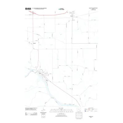
2013 Map of Eldon
USGS Topo · Published 2013About this map
Eldon and its surroundings in Wapello County are defined by the winding course of the Des Moines River, which anchors the southern half of the landscape. This 2013 survey reveals the spatial arrangement of the town, featuring the Wapello County Fairgrounds prominently to the southeast of the main grid. The map also documents the smaller settlements of Batavia in the north and Ashland to the west, linked by a network of rural roads such as 35th Ave and Chief Wapello Rd. The drainage pattern is intricate, with numerous tributaries including Soap Cr, Chippewa Cr, and Rock Cr cutting through the terrain. These waterways and the established street grids in Batavia and Eldon illustrate the enduring agricultural and civic structure of this corner of Iowa.
Find a feature on this map
86 named features on this map. Tap any name to fly to it.
Don’t see what you’re looking for? This feature index may not catch every label — zoom into the map to look around manually.
Map Details
Editions of this 2013 Eldon Map
This is the sole edition of this map. No revisions or reprints were ever made.
Other maps of this area

1954 · Centerville
USGS Topo · 1:250,000

1954 · Des Moines
USGS Topo · 1:250,000

1956 · Des Moines
USGS Topo · 1:250,000

1956 · Farson
USGS Topo · 1:24,000

1956 · Agency
USGS Topo · 1:24,000

1956 · Ottumwa North
USGS Topo · 1:62,500

1956 · Ottumwa South
USGS Topo · 1:62,500

1957 · Des Moines
USGS Topo · 1:250,000

1957 · Centerville
USGS Topo · 1:250,000

1958 · Centerville
USGS Topo · 1:250,000