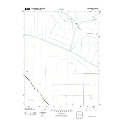
2012 Map of Eldorado Bend
USGS Topo · Published 2012About this map
The Sacramento River carves a winding path through this agricultural landscape, forming distinctive oxbows such as Eldorado Bend, State Ranch Bend, and Missouri Bend. This modern survey reveals a highly managed water system, dominated by the linear Colusa Basin Drainage Canal which cuts diagonally across the terrain to control flooding and irrigation. The small settlements of Zamora and Dufour anchor the rural infrastructure, connected by a rigid grid of local roads and farm lanes. Local history and genealogy interest is concentrated at Marys Cem, a quiet landmark in a region defined by its river-landing history, including the evocatively named Rough and Ready Landing. The map illustrates the persistence of a 19th-century land-use pattern adapted to 21st-century water management needs in the Sacramento Valley.
Find a feature on this map
36 named features on this map. Tap any name to fly to it.
Don’t see what you’re looking for? This feature index may not catch every label — zoom into the map to look around manually.
Map Details
Editions of this 2012 Eldorado Bend Map
This is the sole edition of this map. No revisions or reprints were ever made.
Other maps of this area

1907 · Dunnigan
USGS Topo · 1:62,500

1907 · Woodland
USGS Topo · 1:62,500

1907 · Davisville
USGS Topo · 1:62,500

1910 · Knights Landing
USGS Topo · 1:31,680

1910 · Marcuse
USGS Topo · 1:31,680

1915 · Yolo
USGS Topo · 1:31,680

1915 · Ronda
USGS Topo · 1:31,680
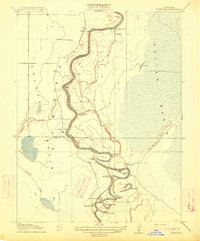
1915 · Kirkville
USGS Topo · 1:31,680

1916 · Grays Bend
USGS Topo · 1:31,680

1916 · Jacobs Corner
USGS Topo · 1:31,680