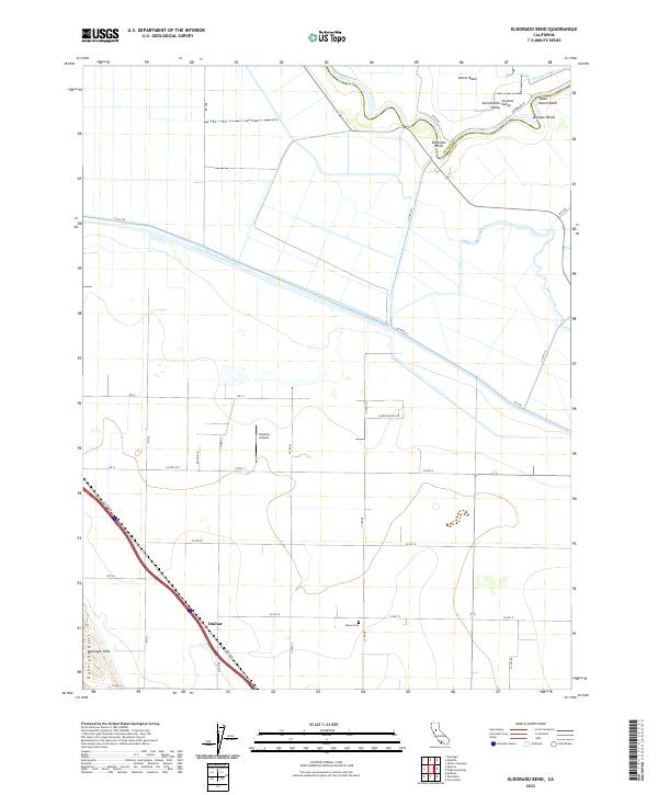
2022 Map of Eldorado Bend
USGS Topo · Published 2022About this map
The Sacramento River meanders through the heart of the Central Valley, defining the jagged boundary between Sutter and Yolo Counties. This modern landscape is a complex network of water management and agricultural infrastructure, where the Colusa Basin Drainage Canal and the W Side Canal cut across the flat valley floor to regulate the seasonal flow of the Sacramento. The settlement of Eldorado Bend sits prominently along the river's eastern curve, while the community of Dufour anchors the southwestern corner near the rising slopes of the Dunnigan Hills. Genealogists and local historians will find Marys Cem situated along Co Rd 98, providing a specific point of interest for family research. The map also highlights local transportation and utility hubs, including the Zamora Airport and the strategic river bends of State Ranch Bend and Missouri Bend.
Find a feature on this map
78 named features on this map. Tap any name to fly to it.
Don’t see what you’re looking for? This feature index may not catch every label — zoom into the map to look around manually.
Map Details
Editions of this 2022 Eldorado Bend Map
This is the sole edition of this map. No revisions or reprints were ever made.
Other maps of this area

1907 · Dunnigan
USGS Topo · 1:62,500

1907 · Woodland
USGS Topo · 1:62,500

1907 · Davisville
USGS Topo · 1:62,500

1910 · Knights Landing
USGS Topo · 1:31,680

1910 · Marcuse
USGS Topo · 1:31,680

1915 · Yolo
USGS Topo · 1:31,680

1915 · Ronda
USGS Topo · 1:31,680
1915 · Kirkville
USGS Topo · 1:31,680

1916 · Grays Bend
USGS Topo · 1:31,680

1916 · Jacobs Corner
USGS Topo · 1:31,680