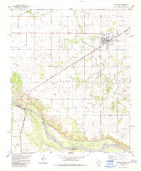
1984 Map of Eldorado
USGS Topo · Published 1985About this map
Eldorado serves as the focal point for this Southwest Oklahoma survey, situated just north of the Oklahoma-Texas border. The town is defined by its position on the Burlington Northern railroad line, which cuts diagonally across the landscape toward the Red River at the southwestern corner. The surrounding terrain is primarily agricultural, punctuated by local landmarks like the Antioch Cem and Durham Cem, which offer significant value for genealogical research in Jackson County. Water management is a visible priority, evidenced by the Sewage Disposal Ponds and a Gaging Sta monitoring the river. The presence of a Gravel Pit and multiple wells suggests a local economy tied to natural resource extraction during the early 1980s. Sandy Creek meanders through the central and northern sections, providing natural drainage for the plains surrounding the town.
Find a feature on this map
14 named features on this map. Tap any name to fly to it.
Don’t see what you’re looking for? This feature index may not catch every label — zoom into the map to look around manually.
Map Details
Editions of this 1984 Eldorado Map
This is the sole edition of this map. No revisions or reprints were ever made.
Other maps of this area

1955 · Lawton
USGS Topo · 1:250,000

1960 · Goodlett
USGS Topo · 1:62,500

1960 · Quanah
USGS Topo · 1:62,500

1961 · Hollis
USGS Topo · 1:62,500

1971 · Duke SW
USGS Topo · 1:24,000

1971 · Prairie Hill
USGS Topo · 1:24,000

1975 · Hollis SE
USGS Topo · 1:24,000

1975 · Quanah NE
USGS Topo · 1:24,000

1975 · Quanah NW
USGS Topo · 1:24,000
1984 · Quanah NE
USGS Topo · 1:24,000