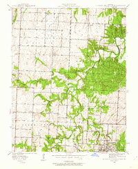
1939 Map of Eldorado Springs North
USGS Topo · Published 1962About this map
Eldorado Springs serves as the regional hub at the southern edge of this West-Central Missouri landscape, where the Court House and Community Bldg anchor the street grid. The 1930s rural economy is mapped in detail, showing a network of country schools like Prairie Valley Sch and Jackson Sch that once served the surrounding farmsteads. The Missouri Kansas Texas railroad cuts through the terrain, facilitating transport across the county lines of Vernon, Cedar, and St. Clair.
Find a feature on this map
34 named features on this map. Tap any name to fly to it.
Don’t see what you’re looking for? This feature index may not catch every label — zoom into the map to look around manually.
Map Details
Editions of this 1939 Eldorado Springs North Map
2 editions found

Other maps of this area

1886 · Nevada
USGS Topo · 1:125,000

1886 · Stockton
USGS Topo · 1:125,000

1887 · Clinton
USGS Topo · 1:125,000

1887 · Butler
USGS Topo · 1:125,000

1894 · Butler
USGS Topo · 1:125,000

1894 · Nevada
USGS Topo · 1:125,000

1894 · Clinton
USGS Topo · 1:125,000

1934 · Papinsville
USGS Topo · 1:24,000

1934 · Rockville
USGS Topo · 1:24,000

1937 · Tiffin
USGS Topo · 1:31,680