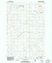
1991 Map of Eldridge SW
USGS Topo · Published 1995About this map
National Waterfowl Production Area parcels dominate this 1990s prairie landscape, reflecting a region dedicated to conservation within the Prairie Pothole Region of North Dakota. The terrain is defined by the expansive Lippert Flats and the meandering path of Beaver Creek, which cuts through the southern half of the quadrangle. This survey, updated from mid-century topographic records, shows a sparse settlement pattern characteristic of Stutsman County. Boundary lines for Moon Lake, Cousator, and Lenton townships delineate the rural infrastructure, where small seasonal wetlands and depressions are scattered across the plains. The map highlights the intersection of public conservation lands and private agricultural holdings during a period of modern environmental management.
Find a feature on this map
8 named features on this map. Tap any name to fly to it.
Don’t see what you’re looking for? This feature index may not catch every label — zoom into the map to look around manually.
Map Details
Editions of this 1991 Eldridge SW Map
This is the sole edition of this map. No revisions or reprints were ever made.
Other maps of this area

1896 · Jamestown
USGS Topo · 1:125,000

1951 · Eldridge SE
USGS Topo · 1:24,000

1951 · Eldridge NW
USGS Topo · 1:24,000

1952 · Eldridge
USGS Topo · 1:24,000

1952 · Jud NW
USGS Topo · 1:24,000

1952 · Eldridge SW
USGS Topo · 1:24,000

1953 · Jamestown
USGS Topo · 1:250,000

1953 · Cleveland SE
USGS Topo · 1:24,000

1953 · Millarton
USGS Topo · 1:24,000

1953 · Cleveland
USGS Topo · 1:24,000