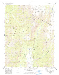
1984 Map of Elephant Head Rock
USGS Topo · Published 1991About this map
The Chalk Mountains define the high-elevation landscape of this 1984 survey, where the Navajo River and East Fork Navajo River gather from the southern slopes of the Continental Divide. The map documents a sparsely populated but active backcountry used for grazing and water management, illustrated by the Bond House at Meadow and the Fall Creek Reservoir.
Find a feature on this map
48 named features on this map. Tap any name to fly to it.
Don’t see what you’re looking for? This feature index may not catch every label — zoom into the map to look around manually.
Map Details
Editions of this 1984 Elephant Head Rock Map
4 editions found
Other maps of this area

1913 · Summitville
USGS Topo · 1:125,000

1915 · Summitville
USGS Topo · 1:125,000

1945 · Durango
USGS Topo · 1:250,000

1953 · Durango
USGS Topo · 1:250,000

1954 · Durango
USGS Topo · 1:250,000

1957 · Chromo
USGS Topo · 1:62,500

1957 · Wolf Creek Pass
USGS Topo · 1:62,500

1957 · Chama Peak
USGS Topo · 1:62,500

1961 · Durango
USGS Topo · 1:250,000

1963 · Durango
USGS Topo · 1:250,000