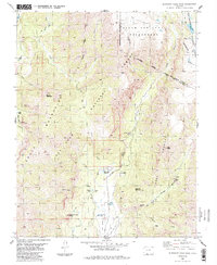
1984 Map of Elephant Head Rock
USGS Topo · Published 1991About this map
Elephant Head Rock stands as a prominent landmark in this high-altitude landscape within the San Juan Mountains, where the Tierra Amarilla Grant meets the boundaries of the San Juan National Forest and the South San Juan Wilderness. The area is defined by its complex drainage network, notably the Navajo River and its various forks and falls, including Bridal Veil Falls and the curiously named Vampire Falls in Vampire Valley. Human presence is sparse and concentrated near water and mountain access, evidenced by Bond House, Meadow, and the Fall Creek Reservoir. A network of 4wd tracks and a pack trail trace the rugged topography, connecting sites like Upper Camp and Lucky Pierre Park. The map documents a wilderness transition, capturing the intersection of private land grants and federal forest lands during the mid-1980s.
Find a feature on this map
49 named features on this map. Tap any name to fly to it.
Don’t see what you’re looking for? This feature index may not catch every label — zoom into the map to look around manually.
Map Details
Editions of this 1984 Elephant Head Rock Map
4 editions found
Other maps of this area

1913 · Summitville
USGS Topo · 1:125,000

1915 · Summitville
USGS Topo · 1:125,000

1945 · Durango
USGS Topo · 1:250,000

1953 · Durango
USGS Topo · 1:250,000

1954 · Durango
USGS Topo · 1:250,000

1957 · Chromo
USGS Topo · 1:62,500

1957 · Wolf Creek Pass
USGS Topo · 1:62,500

1957 · Chama Peak
USGS Topo · 1:62,500

1961 · Durango
USGS Topo · 1:250,000

1963 · Durango
USGS Topo · 1:250,000