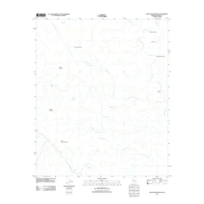
2011 Map of Elevator Mountain
USGS Topo · Published 2011About this map
Elevator Mountain and Mescal Mountain anchor a landscape defined by an intricate network of desert water sources and livestock range. This Graham County region shows the importance of springs and tanks for survival and commerce in the early 21st century, with sites like Maverick Spring, Boiling Spring, and Windy Spring scattered across the high ground. The drainage of Eagle Creek runs along the eastern edge, supported by tributaries including Brushy Creek and Pistol Creek. Evidence of ranching operations is found at the Fifteenmile Corral and the Holding Pasture near Ninemile, where the remote Black River RD provides one of the few managed routes through the terrain. The naming conventions—from Kane Spring Mountain to McEwen Trap Spring—point to a history of individual land use and the persistent search for water in this arid stretch of Arizona.
Find a feature on this map
26 named features on this map. Tap any name to fly to it.
Don’t see what you’re looking for? This feature index may not catch every label — zoom into the map to look around manually.
Map Details
Editions of this 2011 Elevator Mountain Map
This is the sole edition of this map. No revisions or reprints were ever made.
Other maps of this area

1902 · Clifton
USGS Topo · 1:62,500

1913 · Morenci
USGS Topo · 1:125,000

1915 · Morenci
USGS Topo · 1:125,000

1954 · Clifton
USGS Topo · 1:250,000

1957 · Clifton
USGS Topo · 1:250,000

1958 · Clifton
USGS Topo · 1:250,000

1962 · Clifton
USGS Topo · 1:250,000

1962 · Clifton
USGS Topo · 1:62,500

1962 · Bryce Mountain
USGS Topo · 1:62,500
1967 · Bee Canyon
USGS Topo · 1:24,000