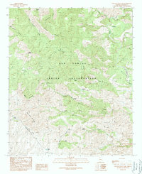
1989 Map of Elevator Mountain
USGS Topo · Published 1990About this map
The San Carlos Indian Reservation occupies the center of this high-elevation terrain, where complex drainages and volcanic peaks define the landscape. This late-twentieth-century survey highlights a remote network of springs and water tanks essential for land management and cattle ranching in the arid Arizona interior. Large landforms like Elevator Mountain, Brushy Mountain, and Kane Spring Mountain dominate the topography, while the Black River Transmission Line provides a rare mark of modern infrastructure cutting through the canyons. Numerous water sources such as Maverick Spring, Sycamore Springs, and Boiling Spring are carefully documented, along with seasonal watercourses like Eagle Creek and Cienega Creek. These features indicate a terrain where water access dictated the placement of corrals and early ranching improvements, providing a clear record of the area's development before more recent environmental or logistical changes.
Find a feature on this map
32 named features on this map. Tap any name to fly to it.
Don’t see what you’re looking for? This feature index may not catch every label — zoom into the map to look around manually.
Map Details
Editions of this 1989 Elevator Mountain Map
This is the sole edition of this map. No revisions or reprints were ever made.
Other maps of this area

1902 · Clifton
USGS Topo · 1:62,500

1913 · Morenci
USGS Topo · 1:125,000

1915 · Morenci
USGS Topo · 1:125,000

1954 · Clifton
USGS Topo · 1:250,000

1957 · Clifton
USGS Topo · 1:250,000

1958 · Clifton
USGS Topo · 1:250,000

1962 · Clifton
USGS Topo · 1:250,000

1962 · Clifton
USGS Topo · 1:62,500

1962 · Bryce Mountain
USGS Topo · 1:62,500
1967 · Bee Canyon
USGS Topo · 1:24,000