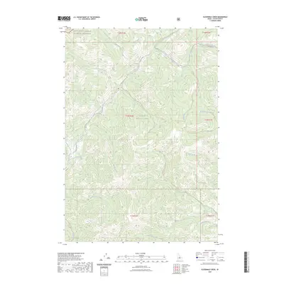
2023 Map of Elevenmile Creek
USGS Topo · Published 2023About this map
The Challis National Forest dominates this landscape, where high-elevation drainages converge and primitive routes provide the only access into the backcountry. The map captures a transition of protected lands, with the northern reaches designated as the Frank Church-River of No Return Wilderness. A complex system of numbered drainages, including Twelvemile Creek, Elevenmile Creek, and Tenmile Creek, flow into the Yankee Fork, illustrating the area's role as a major watershed. Historical land use is evident in the naming of the Custer Trail Rd #013 and specialized paths like the Peach Cinnabar Trl, which suggests the region's mineral prospecting past. High-altitude features such as Milk Lake and the peak of Paasásikwana Naakwaide stand as remote landmarks within a terrain defined by steep contours and isolated creek basins.
Find a feature on this map
33 named features on this map. Tap any name to fly to it.
Don’t see what you’re looking for? This feature index may not catch every label — zoom into the map to look around manually.
Map Details
Editions of this 2023 Elevenmile Creek Map
This is the sole edition of this map. No revisions or reprints were ever made.
Other maps of this area

1919 · Custer
USGS Topo · 1:125,000

1922 · Custer
USGS Topo · 1:125,000

1929 · Bayhorse
USGS Topo · 1:125,000

1930 · Casto
USGS Topo · 1:125,000

1956 · Twin Peaks
USGS Topo · 1:62,500

1957 · Challis
USGS Topo · 1:250,000

1960 · Challis
USGS Topo · 1:250,000

1963 · Challis
USGS Topo · 1:250,000

1963 · Challis Creek Lakes
USGS Topo · 1:24,000

1963 · Custer
USGS Topo · 1:24,000