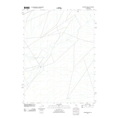
2012 Map of Elevenmile Well
USGS Topo · Published 2012About this map
Hot Springs Ranch and Lower Clover Ranch anchor this high-desert landscape in Elko County, reflecting the enduring presence of cattle ranching in the Great Basin. This 2012 survey shows the sparse water resources and intricate road networks vital for remote agricultural operations. The northern reach is defined by the winding course of Jake Creek, while Evans Creek cuts across the center, eventually passing near the established ranch headquarters. In the southern sector, the eponymous Elevenmile Well serves as a critical waypoint, illustrating the reliance on groundwater for livestock in this arid interior. The map documents a terrain where the intersection of natural drainage and human habitation is dictated by these limited water sources.
Find a feature on this map
5 named features on this map. Tap any name to fly to it.
Don’t see what you’re looking for? This feature index may not catch every label — zoom into the map to look around manually.
Map Details
Editions of this 2012 Elevenmile Well Map
This is the sole edition of this map. No revisions or reprints were ever made.
Other maps of this area

1882 · Paradise
USGS Topo · 1:250,000

1893 · Paradise
USGS Topo · 1:250,000

1932 · Sonoma Range
USGS Topo · 1:250,000

1939 · Sonoma Range
USGS Topo · 1:250,000

1955 · McDermitt
USGS Topo · 1:250,000

1955 · Winnemucca
USGS Topo · 1:250,000

1958 · Winnemucca
USGS Topo · 1:250,000

1959 · McDermitt
USGS Topo · 1:250,000

1962 · Winnemucca
USGS Topo · 1:250,000

1965 · Knight
USGS Topo · 1:24,000