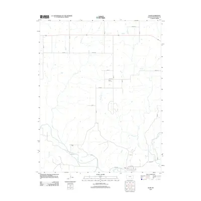
2012 Map of Elgin
USGS Topo · Published 2012About this map
Caney River winds across the southern reaches of this Chautauqua County landscape, creating a fertile basin where the local settlement pattern is most concentrated. A network of rural routes including Heritage Rd and Gallop Rd crisscrosses the prairie, connecting several long-standing community landmarks. The distribution of family and district burial grounds throughout the countryside offers significant clues for genealogists and local historians. Features like Moore Prairie Cem and De Bask Cem are positioned along the upper drainages of Sycamore Cr, while Elgin Cem and District 1 Cem are located near the primary river corridor. This drainage system, including Cedar Cr and Buzzard Cr, continues to define the agricultural boundaries and land use of the region in the early 21st century.
Find a feature on this map
30 named features on this map. Tap any name to fly to it.
Don’t see what you’re looking for? This feature index may not catch every label — zoom into the map to look around manually.
Map Details
Editions of this 2012 Elgin Map
This is the sole edition of this map. No revisions or reprints were ever made.
Other maps of this area

1885 · Sedan
USGS Topo · 1:125,000

1889 · Sedan
USGS Topo · 1:125,000

1909 · Pawhuska
USGS Topo · 1:125,000

1910 · Pawhuska
USGS Topo · 1:125,000

1955 · Wichita
USGS Topo · 1:250,000

1955 · Enid
USGS Topo · 1:250,000

1958 · Enid
USGS Topo · 1:250,000

1958 · Wichita
USGS Topo · 1:250,000

1962 · Sedan
USGS Topo · 1:24,000
1962 · Cedar Vale East
USGS Topo · 1:24,000