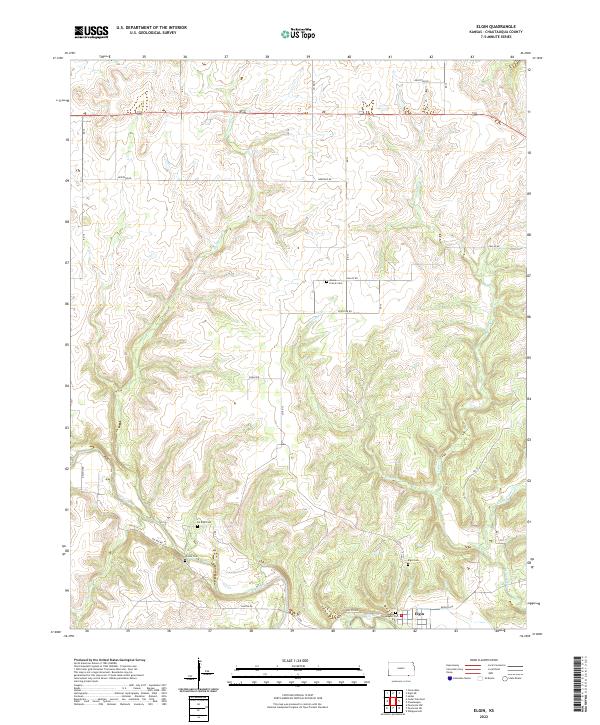
2022 Map of Elgin
USGS Topo · Published 2022About this map
The Caney River winds through the southern reaches of this Chautauqua County landscape, anchoring the settlement of Elgin. This 2022 survey captures a region defined by its watercourses and rural cemeteries, reflecting generations of land use along the Oklahoma border. Numerous tributaries, including Sycamore Cr and W Cedar Cr, carve through the terrain, creating a complex drainage network that historically dictated the placement of roads and homesteads.
Find a feature on this map
26 named features on this map. Tap any name to fly to it.
Don’t see what you’re looking for? This feature index may not catch every label — zoom into the map to look around manually.
Map Details
Editions of this 2022 Elgin Map
This is the sole edition of this map. No revisions or reprints were ever made.
Other maps of this area

1885 · Sedan
USGS Topo · 1:125,000

1889 · Sedan
USGS Topo · 1:125,000

1909 · Pawhuska
USGS Topo · 1:125,000

1910 · Pawhuska
USGS Topo · 1:125,000

1955 · Wichita
USGS Topo · 1:250,000

1955 · Enid
USGS Topo · 1:250,000

1958 · Enid
USGS Topo · 1:250,000

1958 · Wichita
USGS Topo · 1:250,000

1962 · Sedan
USGS Topo · 1:24,000
1962 · Cedar Vale East
USGS Topo · 1:24,000