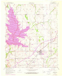
1956 Map of Elgin
USGS Topo · Published 1976About this map
The boundary between Caddo and Comanche Counties anchors this Oklahoma landscape, which underwent significant infrastructure changes during the mid-20th century. The northern reaches of Fort Sill Military Reservation dominate the southern half of the sheet, featuring named high points like Frisco Ridge and livestock infrastructure such as Connell Tank and Rudd Tank. The presence of the H E Bailey Toll Road and the Turnpike reflects the postwar expansion of the regional highway network, cutting across established routes like the St Louis-San Francisco railway.
Find a feature on this map
28 named features on this map. Tap any name to fly to it.
Don’t see what you’re looking for? This feature index may not catch every label — zoom into the map to look around manually.
Map Details
Editions of this 1956 Elgin Map
3 editions found

Other maps of this area

1946 · Lawton
USGS Topo · 1:62,500

1949 · Arbuckle Hill
USGS Topo · 1:24,000

1949 · Cement
USGS Topo · 1:62,500

1949 · Elgin
USGS Topo · 1:24,000

1949 · Fort Sill
USGS Topo · 1:24,000

1949 · Nellie
USGS Topo · 1:62,500

1955 · Lawton
USGS Topo · 1:250,000

1956 · Sterling
USGS Topo · 1:24,000

1956 · Fletcher
USGS Topo · 1:24,000

1956 · Arbuckle Hill
USGS Topo · 1:24,000