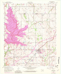
1956 Map of Elgin
USGS Topo · Published 1983About this map
Elgin serves as the primary hub of this landscape at the boundary of Caddo County and Comanche County, showing the transition from agricultural plains to military and recreational use. The town is marked by its grid of streets, Elgin Cemetery, and St Anthonys Church, while the southern portion of the map is dominated by the Fort Sill Military Reservation. This military landscape includes specialized infrastructure like Menard Tank, Rudd Tank, and Frisco Ridge.
Find a feature on this map
29 named features on this map. Tap any name to fly to it.
Don’t see what you’re looking for? This feature index may not catch every label — zoom into the map to look around manually.
Map Details
Editions of this 1956 Elgin Map
3 editions found

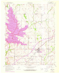
Other maps of this area

1946 · Lawton
USGS Topo · 1:62,500

1949 · Arbuckle Hill
USGS Topo · 1:24,000

1949 · Cement
USGS Topo · 1:62,500

1949 · Elgin
USGS Topo · 1:24,000

1949 · Fort Sill
USGS Topo · 1:24,000

1949 · Nellie
USGS Topo · 1:62,500

1955 · Lawton
USGS Topo · 1:250,000

1956 · Sterling
USGS Topo · 1:24,000

1956 · Fletcher
USGS Topo · 1:24,000

1956 · Arbuckle Hill
USGS Topo · 1:24,000