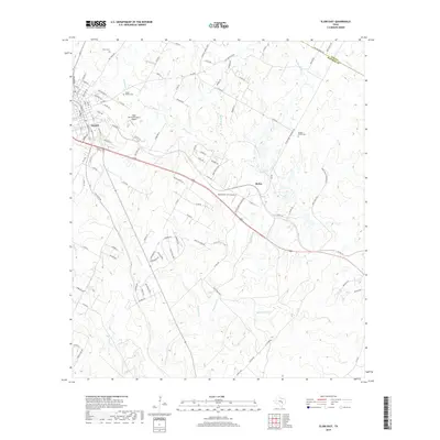
2019 Map of Elgin East
USGS Topo · Published 2019About this map
Elgin and the surrounding Bastrop and Lee County countryside are defined by a network of drainage creeks and small airfield operations in this recent survey. To the east of the city, Butler serves as a small settlement hub while the Elgin Intracontinental Airport and Hawken Air One Airport reflect the area's modern aeronautical activity. The terrain is deeply carved by several major watercourses, including Big Sandy Cr, Little Sandy Cr, and Burlson Cr, which dictate the winding paths of rural roads like Co Rd 106 and Old Sayers Rd.
Find a feature on this map
94 named features on this map. Tap any name to fly to it.
Don’t see what you’re looking for? This feature index may not catch every label — zoom into the map to look around manually.
Map Details
Editions of this 2019 Elgin East Map
This is the sole edition of this map. No revisions or reprints were ever made.
Other maps of this area

1885 · Bastrop
USGS Topo · 1:125,000

1893 · Bastrop
USGS Topo · 1:125,000

1904 · Bastrop
USGS Topo · 1:125,000

1948 · Smithville
USGS Topo · 1:62,500

1948 · Elgin
USGS Topo · 1:62,500

1948 · Bastrop
USGS Topo · 1:62,500

1948 · Lexington
USGS Topo · 1:62,500

1950 · Lexington
USGS Topo · 1:62,500

1950 · Bastrop
USGS Topo · 1:62,500

1950 · Smithville
USGS Topo · 1:62,500