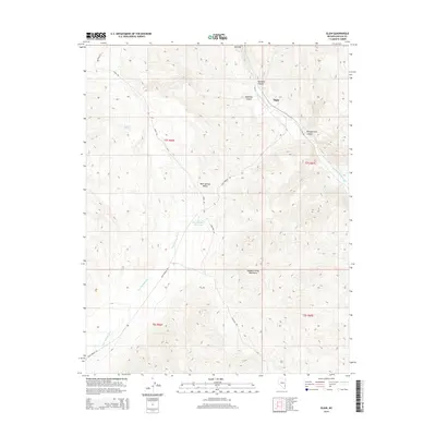
2014 Map of Elgin
USGS Topo · Published 2014About this map
Elgin serves as the focal point of this Lincoln County landscape, situated where the NV-317 follows the path of the Meadow Valley Wash. The settlement is positioned near the dramatic entrance to Rainbow Canyon, a geological transition point where the watercourse cuts through the terrain. The map documents a network of remote desert routes, including Bishop Rd and Riggs Rd, which navigate the high ground of Ash Flat and the surrounding peaks.
Find a feature on this map
20 named features on this map. Tap any name to fly to it.
Don’t see what you’re looking for? This feature index may not catch every label — zoom into the map to look around manually.
Map Details
Editions of this 2014 Elgin Map
This is the sole edition of this map. No revisions or reprints were ever made.
Other maps of this area

1885 · Pioche
USGS Topo · 1:250,000

1886 · Pioche
USGS Topo · 1:250,000

1954 · Caliente
USGS Topo · 1:250,000

1959 · Caliente
USGS Topo · 1:250,000

1969 · Vigo NW
USGS Topo · 1:24,000

1969 · Elgin
USGS Topo · 1:24,000

1969 · Elgin NE
USGS Topo · 1:24,000

1969 · Slidy Mountain
USGS Topo · 1:24,000
1969 · Vigo NE
USGS Topo · 1:24,000

1969 · Elgin SW
USGS Topo · 1:24,000