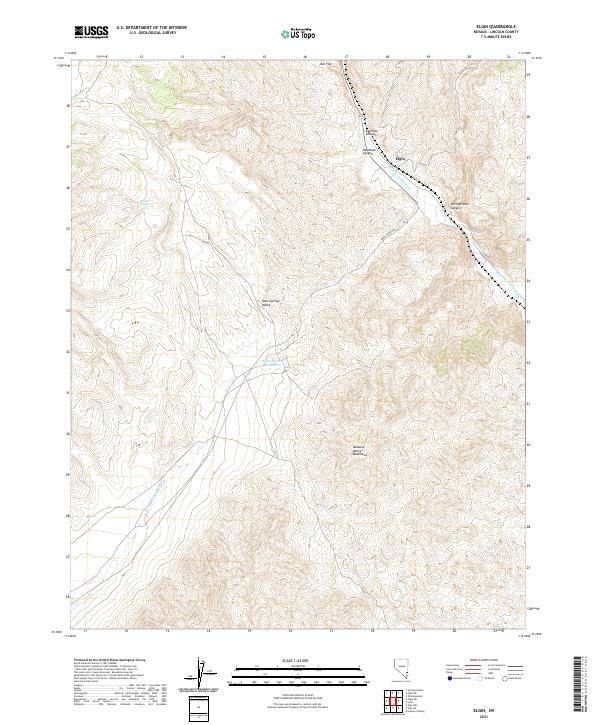
2021 Map of Elgin
USGS Topo · Published 2021About this map
Elgin serves as a lone outpost in this 2021 topographical study of southeastern Lincoln County, where human settlement is sparse against the immense relief of the Meadow Valley Mountains. The landscape is dominated by complex drainage systems and canyons that define travel in this arid region. The narrow corridor of the Meadow Valley Wash winds through Rainbow Canyon and Deadman Canyon, providing a lifeline through the desert floor alongside State Route 317. To the west, the broad Kane Springs Valley is marked by the Elgin Summit Reservoir and the seasonal path of Kane Springs Wash. These features, along with names like Boulder Spring and Pennsylvania Canyon, highlight the critical importance of water and passage in a region where remote desert roads like Kane Springs Rd and Carp Rd connect isolated points across the high-desert basins and flats.
Find a feature on this map
18 named features on this map. Tap any name to fly to it.
Don’t see what you’re looking for? This feature index may not catch every label — zoom into the map to look around manually.
Map Details
Editions of this 2021 Elgin Map
This is the sole edition of this map. No revisions or reprints were ever made.
Other maps of this area

1885 · Pioche
USGS Topo · 1:250,000

1886 · Pioche
USGS Topo · 1:250,000

1954 · Caliente
USGS Topo · 1:250,000

1959 · Caliente
USGS Topo · 1:250,000

1969 · Vigo NW
USGS Topo · 1:24,000

1969 · Elgin
USGS Topo · 1:24,000

1969 · Elgin NE
USGS Topo · 1:24,000

1969 · Slidy Mountain
USGS Topo · 1:24,000
1969 · Vigo NE
USGS Topo · 1:24,000

1969 · Elgin SW
USGS Topo · 1:24,000