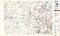
1981 Map of Elgin
USGS Topo · Published 1981About this map
The Fox River valley and its surrounding glacial landscapes are captured here during a period of significant suburban expansion in the early 1980s. The map illustrates a dense network of water bodies in the northeast, including Pistakee Lake and Fox Lake, which are protected by Chain-O-Lakes State Park and the unique Volo Bog State Natural Area. These natural features contrast with the emerging residential patterns in Venetian Village and Round Lake Heights.
Find a feature on this map
194 named features on this map. Tap any name to fly to it.
Don’t see what you’re looking for? This feature index may not catch every label — zoom into the map to look around manually.
Map Details
Editions of this 1981 Elgin Map
This is the sole edition of this map. No revisions or reprints were ever made.
Other maps of this area

1891 · Riverside
USGS Topo · 1:62,500

1891 · Janesville
USGS Topo · 1:62,500

1892 · Racine
USGS Topo · 1:62,500

1893 · Riverside
USGS Topo · 1:62,500

1893 · Delavan
USGS Topo · 1:62,500

1893 · Janesville
USGS Topo · 1:62,500

1893 · Silver Lake
USGS Topo · 1:62,500

1893 · Shopiere
USGS Topo · 1:62,500

1893 · Geneva
USGS Topo · 1:62,500

1900 · Riverside
USGS Topo · 1:62,500