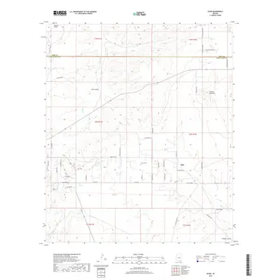
2018 Map of Elgin
USGS Topo · Published 2018About this map
Elgin serves as a central hub in this high-desert landscape of Santa Cruz and Pima counties, where the high plains meet the eastern foothills of the Mustang Mountains. The terrain is defined by a series of drainage systems, most notably the Babocomari River and Cienega Cr, which carve through the land alongside numerous canyons like Gardner Canyon and Smith Canyon. The map reveals a transition toward organized rural residential development, with a dense network of local roads such as Rain Valley Loop Rd and Elgin Canelo Rd branching out from the main settlement. Genealogy and local history researchers will find the Fruitland Cem located along Prairie Ln, a quiet landmark amidst the vast ranching allotments and township boundaries that still dictate the regional geography.
Find a feature on this map
46 named features on this map. Tap any name to fly to it.
Don’t see what you’re looking for? This feature index may not catch every label — zoom into the map to look around manually.
Map Details
Editions of this 2018 Elgin Map
This is the sole edition of this map. No revisions or reprints were ever made.
Other maps of this area

1904 · Patagonia
USGS Topo · 1:125,000

1905 · Patagonia
USGS Topo · 1:125,000

1915 · Benson
USGS Topo · 1:125,000

1926 · Whetstone
USGS Topo · 1:62,500

1932 · Elgin
USGS Topo · 1:62,500

1938 · Huachuca
USGS Topo · 1:62,500

1940 · Elgin
USGS Topo · 1:62,500

1943 · Benson
USGS Topo · 1:125,000

1947 · Elgin
USGS Topo · 1:62,500

1948 · Elgin
USGS Topo · 1:24,000