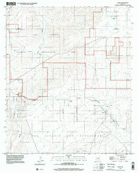
1996 Map of Elgin
USGS Topo · Published 2002About this map
Las Cienegas National Conservation Area anchors this landscape of the High Desert at the turn of the millennium, straddling the boundary between Pima Co and Santa Cruz Co. The small settlement of Elgin is situated at the junction of several drainage systems, including the Babocomari River and Cienega Creek. This map preserves the footprint of earlier infrastructure through the Old Railroad Grade, which once connected these cattle-ranching grasslands to larger markets. Cultural history is concentrated near the townsite, where researchers can find the Fruitland Cemetery and an additional unnamed Cemetery further east. The topography rises sharply into the Mustang Mts and descends into deep seasonal drainages such as San Ignacio Del Babocomari Canyon and Vaughn Canyon, illustrating the varied terrain of the Arizona grasslands before significant modern development.
Find a feature on this map
22 named features on this map. Tap any name to fly to it.
Don’t see what you’re looking for? This feature index may not catch every label — zoom into the map to look around manually.
Map Details
Editions of this 1996 Elgin Map
This is the sole edition of this map. No revisions or reprints were ever made.
Other maps of this area

1904 · Patagonia
USGS Topo · 1:125,000

1905 · Patagonia
USGS Topo · 1:125,000

1915 · Benson
USGS Topo · 1:125,000

1926 · Whetstone
USGS Topo · 1:62,500

1932 · Elgin
USGS Topo · 1:62,500

1938 · Huachuca
USGS Topo · 1:62,500

1940 · Elgin
USGS Topo · 1:62,500

1943 · Benson
USGS Topo · 1:125,000

1947 · Elgin
USGS Topo · 1:62,500

1948 · Elgin
USGS Topo · 1:24,000