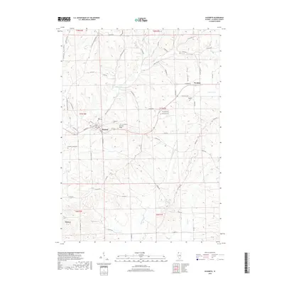
2018 Map of Elizabeth
USGS Topo · Published 2018About this map
Elizabeth sits atop a rise in the Jo Daviess County landscape, where the Apple River carves through the undulating terrain. This area of Northwest Illinois is characterized by deep drainages like Welsh Hollow and Snipe Hollow, which define the local geography alongside the prominent Terrapin Ridge. The settlement patterns show a traditional rural network of family-named roads and small community centers. To the east, Woodbine serves as a secondary focal point, with the Woodbine Cem marking the local history of the township. Local genealogists and historians can trace the early infrastructure through labels like Old Fort Rd and the placement of Saint Marys Cem near the village of Elizabeth. The map details a complex drainage system including Little Rush Cr, Wolf Cr, and Mill Cr, which has historically dictated the placement of agricultural boundaries and transport routes throughout these unglaciated uplands.
Find a feature on this map
73 named features on this map. Tap any name to fly to it.
Don’t see what you’re looking for? This feature index may not catch every label — zoom into the map to look around manually.
Map Details
Editions of this 2018 Elizabeth Map
This is the sole edition of this map. No revisions or reprints were ever made.
Other maps of this area

1892 · Savanna
USGS Topo · 1:62,500

1911 · Elizabeth
USGS Topo · 1:62,500

1911 · Galena
USGS Topo · 1:62,500

1913 · Galena
USGS Topo · 1:62,500

1935 · Miles
USGS Topo · 1:62,500

1936 · Elizabeth
USGS Topo · 1:62,500

1941 · Miles
USGS Topo · 1:62,500

1952 · Savanna
USGS Topo · 1:62,500

1953 · Blackhawk
USGS Topo · 1:24,000

1953 · Green Island
USGS Topo · 1:24,000