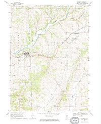
1968 Map of Elizabeth
USGS Topo · Published 1970About this map
The village of Elizabeth sits at the junction of rail and river in this 1960s survey of Jo Daviess County. The Chicago and North Western railroad cuts a diagonal path through the landscape, following the winding valley of the Apple River and connecting smaller outposts like Woodbine. This era captures a rural economy still defined by local landmarks and extractive industries, evidenced by several Quarry sites scattered along the creeks. To the south, the terrain shifts toward Derinda Center and the drainage of Little Rush Creek.
Find a feature on this map
22 named features on this map. Tap any name to fly to it.
Don’t see what you’re looking for? This feature index may not catch every label — zoom into the map to look around manually.
Map Details
Editions of this 1968 Elizabeth Map
This is the sole edition of this map. No revisions or reprints were ever made.
Other maps of this area

1892 · Savanna
USGS Topo · 1:62,500

1911 · Elizabeth
USGS Topo · 1:62,500

1911 · Galena
USGS Topo · 1:62,500

1913 · Galena
USGS Topo · 1:62,500

1935 · Miles
USGS Topo · 1:62,500

1936 · Elizabeth
USGS Topo · 1:62,500

1941 · Miles
USGS Topo · 1:62,500

1952 · Savanna
USGS Topo · 1:62,500

1953 · Blackhawk
USGS Topo · 1:24,000

1953 · Green Island
USGS Topo · 1:24,000