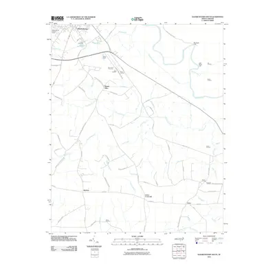
2010 Map of Elizabethtown South
USGS Topo · Published 2010About this map
Elizabethtown and the agricultural lands of Bladen County are defined here by the winding course of the Cape Fear River and a dense network of blackwater creeks. South of the town center, the landscape transitions into a patchwork of rural communities including Mount Olive, Bluefield, and Lisbon. The map reveals a high density of small family and community burial grounds, such as the Mount Olive Cemeteries, Lee Cemetery, and McCall Cemetery, which anchor the history of these farming settlements.
Find a feature on this map
68 named features on this map. Tap any name to fly to it.
Don’t see what you’re looking for? This feature index may not catch every label — zoom into the map to look around manually.
Map Details
Editions of this 2010 Elizabethtown South Map
This is the sole edition of this map. No revisions or reprints were ever made.
Other maps of this area

1953 · Florence
USGS Topo · 1:250,000

1954 · Florence
USGS Topo · 1:250,000

1954 · White Lake
USGS Topo · 1:62,500

1954 · Bolton
USGS Topo · 1:62,500

1955 · Whiteville
USGS Topo · 1:62,500

1955 · Elizabethtown
USGS Topo · 1:62,500

1982 · Elizabethtown
USGS Topo · 1:100,000
1986 · Singletary Lake
USGS Topo · 1:24,000
1986 · Council
USGS Topo · 1:24,000

1986 · Whiteville
USGS Topo · 1:100,000