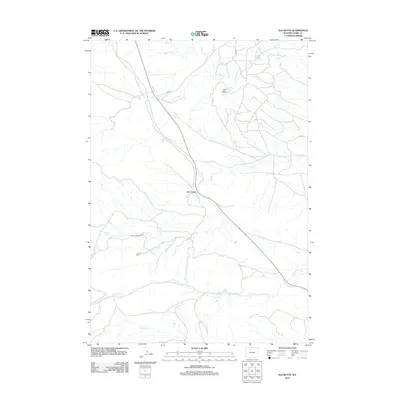
2012 Map of Elk Butte
USGS Topo · Published 2012About this map
Elk Butte dominates the high ground in this arid Wyoming landscape within Park County, surveyed just after the turn of the 21st century. The map provides a clear picture of the hydraulic systems of the high plains, where ephemeral drainage patterns like Dry Creek and its many tributaries, including S Fork Dry Cr, dictate the movement of both water and travelers. The road network reflects a land primarily used for ranching and resource access, defined by routes like Meeteetse Creek Rd and Co Rd 31C. To the south, the terrain descends toward the drainage of Cottonwood Cr, illustrating the sparse but vital water sources that define life and land management in this portion of the Bighorn Basin. The presence of numerous 4WD trails and numbered access roads highlights the area's modern-day utility for local operations.
Find a feature on this map
9 named features on this map. Tap any name to fly to it.
Don’t see what you’re looking for? This feature index may not catch every label — zoom into the map to look around manually.
Map Details
Editions of this 2012 Elk Butte Map
This is the sole edition of this map. No revisions or reprints were ever made.
Other maps of this area

1911 · Meeteetse
USGS Topo · 1:62,500

1911 · Oregon Basin
USGS Topo · 1:62,500

1913 · Oregon Basin
USGS Topo · 1:62,500

1913 · Meeteetse
USGS Topo · 1:62,500

1955 · Cody
USGS Topo · 1:250,000

1957 · Devils Tooth
USGS Topo · 1:62,500

1957 · Sunshine Reservoir
USGS Topo · 1:62,500

1958 · Cody
USGS Topo · 1:250,000

1962 · Cody
USGS Topo · 1:250,000

1980 · Carter Mountain
USGS Topo · 1:100,000