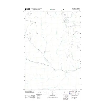
2011 Map of Elk Creek
USGS Topo · Published 2011About this map
May Creek Campground serves as a key recreational anchor in this Montana landscape, situated near the confluence of May Creek and Trail Creek. The area is defined by an intricate drainage system including Joseph Creek, Elk Creek, and Stevenson Creek, which carve through the high-elevation terrain of Beaverhead County. Transportation through these mountain passes is facilitated by the Bitterroot-Big Hole Rd and Tie Creek Rd, reflecting the region's historical reliance on established travel corridors through the Continental Divide. A legacy of industrial infrastructure is evident in the Railroad grade that cuts across the northern reaches, while numerous smaller tributaries like Rat Creek and Hogan Creek highlight the detailed topography of this wilderness area.
Find a feature on this map
18 named features on this map. Tap any name to fly to it.
Don’t see what you’re looking for? This feature index may not catch every label — zoom into the map to look around manually.
Map Details
Editions of this 2011 Elk Creek Map
This is the sole edition of this map. No revisions or reprints were ever made.
Other maps of this area

1955 · Dillon
USGS Topo · 1:250,000

1957 · Dillon
USGS Topo · 1:250,000

1958 · Dillon
USGS Topo · 1:250,000

1962 · Dillon
USGS Topo · 1:250,000

1965 · Dillon
USGS Topo · 1:250,000

1966 · Lost Trail Pass
USGS Topo · 1:24,000

1966 · Big Hole Battlefield
USGS Topo · 1:24,000

1966 · Big Hole Pass
USGS Topo · 1:24,000
1966 · Elk Creek
USGS Topo · 1:24,000
1966 · Isaac Meadows
USGS Topo · 1:24,000