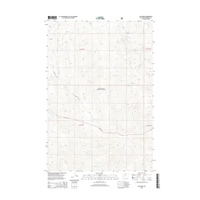
2014 Map of Elk Creek
USGS Topo · Published 2014About this map
The Beaverhead National Forest defines the topography of this Montana landscape, where a complex network of high-country drainage basins feeds into the larger regional river systems. Running through the heart of the area, the Bitterroot-Big Hole Rd and State Hwy 43 provide the primary transit corridors through these wooded slopes and valleys. The map documents a classic Western water distribution pattern, with numerous primary streams like Elk Creek, Tie Creek, and Joseph Creek carving out distinct drainages. Notable smaller tributaries including Sunshine Creek, Prairie Creek, and Shoofly Creek suggest a highly dissected terrain where the natural flow of water dictated early trail and road placement. This 2014 survey serves as a modern record of land management boundaries and hydrological features within the southwestern Montana wilderness.
Find a feature on this map
25 named features on this map. Tap any name to fly to it.
Don’t see what you’re looking for? This feature index may not catch every label — zoom into the map to look around manually.
Map Details
Editions of this 2014 Elk Creek Map
This is the sole edition of this map. No revisions or reprints were ever made.
Other maps of this area

1955 · Dillon
USGS Topo · 1:250,000

1957 · Dillon
USGS Topo · 1:250,000

1958 · Dillon
USGS Topo · 1:250,000

1962 · Dillon
USGS Topo · 1:250,000

1965 · Dillon
USGS Topo · 1:250,000

1966 · Lost Trail Pass
USGS Topo · 1:24,000

1966 · Big Hole Battlefield
USGS Topo · 1:24,000

1966 · Big Hole Pass
USGS Topo · 1:24,000
1966 · Elk Creek
USGS Topo · 1:24,000
1966 · Isaac Meadows
USGS Topo · 1:24,000