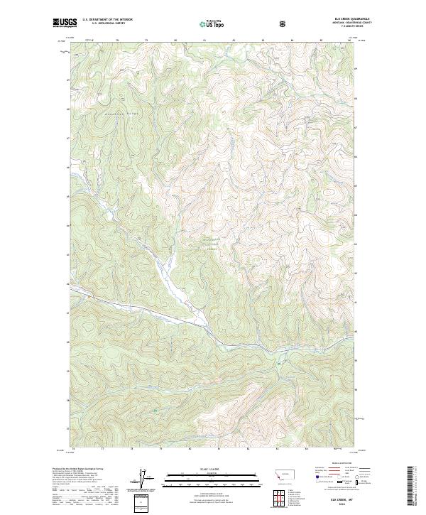
2024 Map of Elk Creek
USGS Topo · Published 2024About this map
The Anaconda Range defines the northern reaches of this high-altitude landscape, where the headwaters of numerous creeks converge within the Beaverhead National Forest. This modern record of the Montana high country shows a complex drainage system fed by features like the 02S18W23ADDB01 Spring, which sustains the flow of May Creek and Stevenson Creek. The human footprint here is primarily defined by forestry and historic transit routes, most notably the Bitterroot-Big Hole Rd which parallels Joseph Creek and Trail Creek as they wind through the mountain passes. The map identifies specific recreational and access paths like the Shoofly Trl, providing a clear look at how the region's steep topography is navigated today. This survey is particularly useful for understanding the hydrologic patterns and access points across the Divide, where the South Fork Tie Creek and Canyon Creek carve deep into the wilderness.
Find a feature on this map
25 named features on this map. Tap any name to fly to it.
Don’t see what you’re looking for? This feature index may not catch every label — zoom into the map to look around manually.
Map Details
Editions of this 2024 Elk Creek Map
This is the sole edition of this map. No revisions or reprints were ever made.
Other maps of this area

1955 · Dillon
USGS Topo · 1:250,000

1957 · Dillon
USGS Topo · 1:250,000

1958 · Dillon
USGS Topo · 1:250,000

1962 · Dillon
USGS Topo · 1:250,000

1965 · Dillon
USGS Topo · 1:250,000

1966 · Lost Trail Pass
USGS Topo · 1:24,000

1966 · Big Hole Battlefield
USGS Topo · 1:24,000

1966 · Big Hole Pass
USGS Topo · 1:24,000
1966 · Elk Creek
USGS Topo · 1:24,000
1966 · Isaac Meadows
USGS Topo · 1:24,000