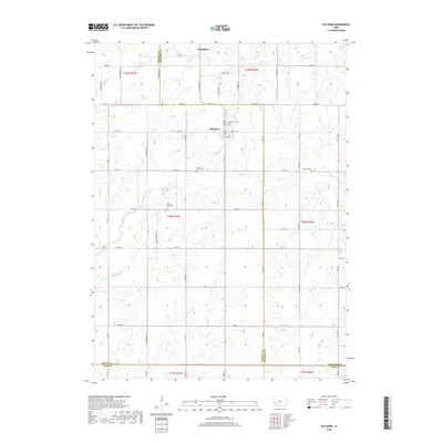
2018 Map of Elk Horn
USGS Topo · Published 2018About this map
Elk Horn and Kimballton serve as the primary population centers in this rural landscape, which spans the border regions of Shelby, Audubon, and Cass counties. The settlement pattern is defined by a dense grid of township roads and agricultural sections, typical of the western Iowa plains. Local heritage is preserved through numerous family and township burial sites, including Elk Horn Cem, Carlsen Larsen Cem, Oakfield Cem, and the Clay Township Cem. A network of small waterways, most notably Elkhorn Cr, Squaw Cr, and Indian Cr, cuts through the undulating terrain, influencing the placement of rural homesteads and historical boundary lines. The infrastructure reflects a deeply established farming community, where the orientation of roads like Co Rd F58 and Street F58 remains central to the region's movement and development.
Find a feature on this map
40 named features on this map. Tap any name to fly to it.
Don’t see what you’re looking for? This feature index may not catch every label — zoom into the map to look around manually.
Map Details
Editions of this 2018 Elk Horn Map
This is the sole edition of this map. No revisions or reprints were ever made.
Other maps of this area

1954 · Omaha
USGS Topo · 1:250,000

1957 · Omaha
USGS Topo · 1:250,000

1957 · Audubon
USGS Topo · 1:62,500

1958 · Omaha
USGS Topo · 1:250,000

1971 · Walnut
USGS Topo · 1:24,000

1971 · Wiota
USGS Topo · 1:24,000

1971 · Atlantic
USGS Topo · 1:24,000

1978 · Elk Horn
USGS Topo · 1:24,000

1978 · Kimballton
USGS Topo · 1:24,000

1978 · Prairie Rose Lake
USGS Topo · 1:24,000