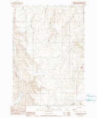
1990 Map of Elk Mountain SE
USGS Topo · Published 1990About this map
Findley Buttes anchor the eastern edge of this high-elevation landscape, where the drainage systems of the Wallowa country diverge toward different river basins. Based on field data from 1987, the map illustrates an intricate network of seasonal and perennial waterways, including the headwaters of Crow Creek and its distinctive forks. The terrain is marked by significant hydraulic features such as Dry Salmon Creek and Deadman Gulch, reflecting the seasonal water movement through these uplands. This area, largely defined by its natural topography rather than permanent settlements, highlights the importancia of the Base Line survey boundary and the intersection of various townships. To the northeast, the land slopes toward West Fork Pine Creek, while the southern reaches are drained by the North Fork Lightning Cr.
Find a feature on this map
16 named features on this map. Tap any name to fly to it.
Don’t see what you’re looking for? This feature index may not catch every label — zoom into the map to look around manually.
Map Details
Editions of this 1990 Elk Mountain SE Map
This is the sole edition of this map. No revisions or reprints were ever made.
Other maps of this area

1954 · Imnaha
USGS Topo · 1:62,500

1954 · Harl Butte
USGS Topo · 1:62,500

1955 · Grangeville
USGS Topo · 1:250,000

1957 · Joseph
USGS Topo · 1:62,500

1957 · Elk Mountain
USGS Topo · 1:62,500

1959 · Grangeville
USGS Topo · 1:250,000

1980 · Grangeville
USGS Topo · 1:100,000

1982 · Wallowa
USGS Topo · 1:100,000

1986 · Enterprise
USGS Topo · 1:100,000

1987 · Riggins
USGS Topo · 1:100,000