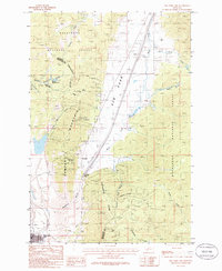
1985 Map of Elk Park Pass
USGS Topo · Published 1986About this map
The Continental Divide zigzags through this high-altitude landscape, separating the headwaters of Lowland Creek and Bison Creek. Centered on the broad expanse of Elk Park, the map captures the transition from heavy timber to open mountain meadows. Human impact on the land is evident in the industrial footprints near Silver Bow Park, where a large Tailings Pond and several Mine Dumps reflect the region's mining heritage.
Find a feature on this map
30 named features on this map. Tap any name to fly to it.
Don’t see what you’re looking for? This feature index may not catch every label — zoom into the map to look around manually.
Map Details
Editions of this 1985 Elk Park Pass Map
2 editions found
Other maps of this area

1889 · Helena
USGS Topo · 1:250,000

1893 · Helena
USGS Topo · 1:250,000

1893 · Dillon
USGS Topo · 1:250,000

1899 · Boulder
USGS Topo · 1:125,000

1899 · Helena
USGS Topo · 1:250,000

1903 · Helena
USGS Topo · 1:250,000

1947 · Butte
USGS Topo · 1:250,000

1954 · Elk Park
USGS Topo · 1:62,500

1955 · Dillon
USGS Topo · 1:250,000

1957 · Dillon
USGS Topo · 1:250,000