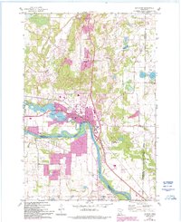
1961 Map of Elk River
USGS Topo · Published 1993About this map
The confluence of the Elk River and the Mississippi River anchors this 1961 survey, which captures the community of Elk River as it balanced its riverfront industry with residential expansion. The presence of a Powerplant, Gaging Sta, and Sewage Disposal facility near the river banks reflects the city's role as a local utility and infrastructure hub. Cultural and civic life is centered around local institutions like the Jr High Sch, High Sch, and several religious sites, including St Andrews Cem and Orono Cem.
Find a feature on this map
29 named features on this map. Tap any name to fly to it.
Don’t see what you’re looking for? This feature index may not catch every label — zoom into the map to look around manually.
Map Details
Editions of this 1961 Elk River Map
3 editions found

Other maps of this area

1902 · Anoka
USGS Topo · 1:62,500

1909 · Rockford
USGS Topo · 1:62,500

1916 · St. Francis
USGS Topo · 1:62,500

1919 · St. Francis
USGS Topo · 1:62,500

1953 · Stillwater
USGS Topo · 1:250,000

1955 · Anoka
USGS Topo · 1:24,000

1955 · Anoka
USGS Topo · 1:62,500

1955 · Stillwater
USGS Topo · 1:250,000

1958 · Stillwater
USGS Topo · 1:250,000

1958 · Rockford
USGS Topo · 1:62,500