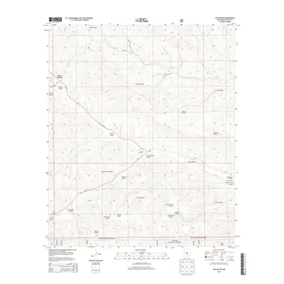
2013 Map of Elk-Silver
USGS Topo · Published 2013About this map
Silver Springs and the nearby Camp Geronimo are the primary points of interest in this high-elevation landscape within the Lincoln National Forest. Situated in the Sacramento Mountains, the terrain is defined by a dense network of drainages including Silver Springs Cr and numerous canyons such as Cooley Canyon, Nahtzillee Canyon, and Turkey Spring Canyon. This 2013 survey illustrates the modern management of these ancestral lands, where Indian Service Route 13 and Indian Service Route 21 provide access across the Mescalero Apache reservation area. Water sources like Dolan Well, Cherry Spring, and Mogoosh Tank are vital markers in this arid mountain environment, reflecting the ongoing necessity of distributed water points for both livestock and wildlife in the Sacramento range.
Find a feature on this map
38 named features on this map. Tap any name to fly to it.
Don’t see what you’re looking for? This feature index may not catch every label — zoom into the map to look around manually.
Map Details
Editions of this 2013 Elk-Silver Map
This is the sole edition of this map. No revisions or reprints were ever made.
Other maps of this area

1952 · Cloudcroft
USGS Topo · 1:62,500

1954 · Carlsbad
USGS Topo · 1:250,000

1955 · Roswell
USGS Topo · 1:250,000

1958 · Carlsbad
USGS Topo · 1:250,000

1958 · Roswell
USGS Topo · 1:250,000

1962 · Roswell
USGS Topo · 1:250,000

1963 · Mayhill
USGS Topo · 1:24,000

1963 · Turkey Peak
USGS Topo · 1:24,000
1963 · Pajarita Mountain
USGS Topo · 1:24,000

1963 · Firman Canyon
USGS Topo · 1:24,000