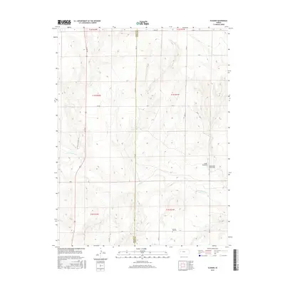
2015 Map of Elkader
USGS Topo · Published 2015About this map
The Smoky Hill River carves its path through the western Kansas landscape on the border of Logan and Gove counties. This high-plains terrain is marked by the erosion of Niobrara Chalk, resulting in prominent landmarks like the Chalk Pyramids and Monument Rocks Arch. These geological formations stand as sentinels over a region defined by its historic transit routes, most notably the path of the Butterfield Overland Trl, which provided a vital stagecoach link during the mid-19th century.
Find a feature on this map
19 named features on this map. Tap any name to fly to it.
Don’t see what you’re looking for? This feature index may not catch every label — zoom into the map to look around manually.
Map Details
Editions of this 2015 Elkader Map
This is the sole edition of this map. No revisions or reprints were ever made.
Other maps of this area

1939 · Lake Mc Bride
USGS Topo · 1:24,000

1939 · Sandon
USGS Topo · 1:62,500

1942 · Sandon
USGS Topo · 1:62,500

1942 · Lake Mc Bride
USGS Topo · 1:31,680

1955 · Scott City
USGS Topo · 1:250,000

1958 · Scott City
USGS Topo · 1:250,000

1972 · Elkader NW
USGS Topo · 1:24,000

1972 · Orion
USGS Topo · 1:24,000

1972 · Elkader NE
USGS Topo · 1:24,000

1974 · Healy NW
USGS Topo · 1:24,000