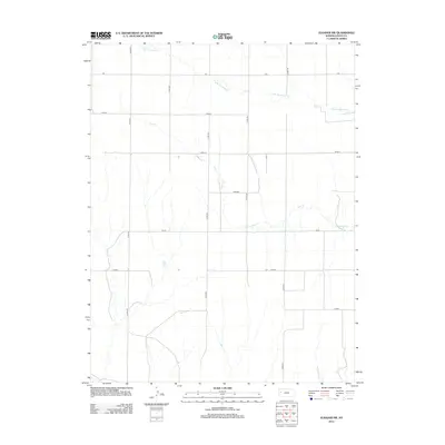
2012 Map of Elkader NW
USGS Topo · Published 2012About this map
S Br Hackberry Cr and Plum Cr define the hydrological layout of this Logan County landscape, where the high plains are segmented by a strictly orthogonal road network. These section-line roads, many bearing names that evoke Kansas history and indigenous heritage such as Topeka, Seneca, and Osage, underscore the systematic agricultural partitioning of the region. The map captures the intersection of natural drainage patterns with human-imposed geometry, seen clearly where routes like Rawhide and Quail cross the intermittent stream beds. This area remains primarily defined by its vast agricultural utility, with the transportation grid of county roads, including Co RD-390 and Co RD-410, providing the essential infrastructure for the rural community.
Find a feature on this map
14 named features on this map. Tap any name to fly to it.
Don’t see what you’re looking for? This feature index may not catch every label — zoom into the map to look around manually.
Map Details
Editions of this 2012 Elkader NW Map
This is the sole edition of this map. No revisions or reprints were ever made.
Other maps of this area

1954 · Goodland
USGS Topo · 1:250,000

1955 · Scott City
USGS Topo · 1:250,000

1956 · Goodland
USGS Topo · 1:250,000

1957 · Goodland
USGS Topo · 1:250,000

1958 · Scott City
USGS Topo · 1:250,000

1972 · Monument
USGS Topo · 1:24,000

1972 · Elkader NW
USGS Topo · 1:24,000

1972 · Elkader NE
USGS Topo · 1:24,000
1972 · Russell Springs NE
USGS Topo · 1:24,000

1974 · Elkader SW
USGS Topo · 1:24,000