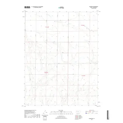
2018 Map of Elkader NW
USGS Topo · Published 2018About this map
S Br Hackberry Cr and Plum Cr define the drainage patterns of this Logan County landscape, where the High Plains transition into dissected breaks. The 2018 survey reveals a highly organized township and range system, with section lines marked by a network of county roads including Co RD 400 and Co RD 370. These north-south arteries facilitate travel through a region historically divided into grazing and agricultural tracts such as Rawhide, Seneca, and Plains. The map's contour lines illustrate the subtle but significant elevation changes between the upland flats and the creek beds, providing a clear picture of the local topography used by ranchers and land managers in the modern era.
Find a feature on this map
19 named features on this map. Tap any name to fly to it.
Don’t see what you’re looking for? This feature index may not catch every label — zoom into the map to look around manually.
Map Details
Editions of this 2018 Elkader NW Map
This is the sole edition of this map. No revisions or reprints were ever made.
Other maps of this area

1954 · Goodland
USGS Topo · 1:250,000

1955 · Scott City
USGS Topo · 1:250,000

1956 · Goodland
USGS Topo · 1:250,000

1957 · Goodland
USGS Topo · 1:250,000

1958 · Scott City
USGS Topo · 1:250,000

1972 · Monument
USGS Topo · 1:24,000

1972 · Elkader NW
USGS Topo · 1:24,000

1972 · Elkader NE
USGS Topo · 1:24,000
1972 · Russell Springs NE
USGS Topo · 1:24,000

1974 · Elkader SW
USGS Topo · 1:24,000