
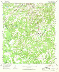
1951 Map of Elkhart
USGS Topo · Published 1952About this map
Elkhart and the surrounding piney woods of East Texas are defined here by a dense network of rural community centers, schools, and family burial grounds in the early 1950s. The landscape is marked by the industrial activity of Oil Wells and a southern Oil Refinery, while the western edge is bounded by the winding Trinity River and its protective Levee. Notable for local history is the Old Salt Works Lake and the Fort Houston Cem, alongside numerous small country churches like St Anna Ch and New Salem Ch. The influence of the Missouri Pacific and Southern Pacific railroads is evident, anchoring the growth of settlements like Tucker and Cronin. This survey provides a clear view of the transition between the agricultural river bottoms and the resource-rich uplands, where features like Lakeview Assembly and the Fish Hatchery highlight the varied land use of the era.
Find a feature on this map
88 named features on this map. Tap any name to fly to it.
Don’t see what you’re looking for? This feature index may not catch every label — zoom into the map to look around manually.
Map Details
Editions of this 1951 Elkhart Map
2 editions found
Other maps of this area

1949 · Palestine
USGS Topo · 1:62,500

1949 · Tennessee Colony
USGS Topo · 1:62,500

1950 · Palestine
USGS Topo · 1:62,500

1950 · Tennessee Colony
USGS Topo · 1:62,500

1951 · Grapeland
USGS Topo · 1:24,000

1951 · Jacksonville
USGS Topo · 1:62,500

1952 · Slocum
USGS Topo · 1:62,500

1953 · Palestine
USGS Topo · 1:250,000

1957 · Palestine
USGS Topo · 1:250,000

1964 · Long Lake
USGS Topo · 1:24,000