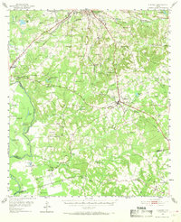
1951 Map of Elkhart
USGS Topo · Published 1969About this map
The Trinity River snakes along the western boundary of this East Texas survey, framing a landscape defined by small rural settlements and a dense network of country schools and churches. Central to the area is the town of Elkhart, where the Missouri Pacific railroad intersects local life. The terrain is dotted with family-named landmarks and spiritual centers such as St Anna Ch and New Salem Ch, which served as the anchors for agrarian communities in the early 1950s.
Find a feature on this map
83 named features on this map. Tap any name to fly to it.
Don’t see what you’re looking for? This feature index may not catch every label — zoom into the map to look around manually.
Map Details
Editions of this 1951 Elkhart Map
2 editions found
Other maps of this area

1949 · Palestine
USGS Topo · 1:62,500

1949 · Tennessee Colony
USGS Topo · 1:62,500

1950 · Palestine
USGS Topo · 1:62,500

1950 · Tennessee Colony
USGS Topo · 1:62,500

1951 · Grapeland
USGS Topo · 1:24,000

1951 · Elkhart
USGS Topo · 1:62,500

1951 · Jacksonville
USGS Topo · 1:62,500

1952 · Slocum
USGS Topo · 1:62,500

1953 · Palestine
USGS Topo · 1:250,000

1957 · Palestine
USGS Topo · 1:250,000