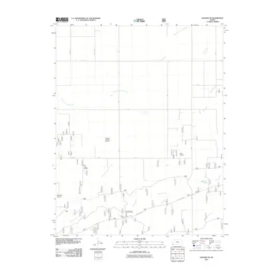
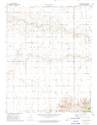
2011 Map of Elkhart NE
USGS Topo · Published 2011About this map
The Cimarron River and its North Fork Cimarron River define the agricultural landscape of Morton County, Kansas. This 2011 survey illustrates a region dominated by large-scale land management, evidenced by the presence of significant grazing tracts like Pasture Number Sixteen, Mills Pasture, and Yoder Pasture. These named pastures reflect the local ranching heritage and the division of the High Plains into distinct territorial units. Along the southern corridor, the George Atwood Recreation Area provides a public landing point near the river's path. The map also documents a precise grid of rural infrastructure, including County Road M and several numeric roads like 13 Rd and 17 Rd, which facilitate transport through this expansive western Kansas territory. Local hydrology is further represented by Wilburton Pond, a localized water source near the eastern edge of the quadrangle.
Find a feature on this map
20 named features on this map. Tap any name to fly to it.
Don’t see what you’re looking for? This feature index may not catch every label — zoom into the map to look around manually.
Map Details
Editions of this 2011 Elkhart NE Map
This is the sole edition of this map. No revisions or reprints were ever made.
Other maps of this area

1955 · Dodge City
USGS Topo · 1:250,000

1958 · Dodge City
USGS Topo · 1:250,000

1959 · Dodge City
USGS Topo · 1:250,000

1973 · Shore Airport SW
USGS Topo · 1:24,000

1973 · Rolla NW
USGS Topo · 1:24,000

1973 · Elkhart NE
USGS Topo · 1:24,000
1973 · Elkhart North
USGS Topo · 1:24,000
1973 · Richfield SW
USGS Topo · 1:24,000
1973 · Richfield
USGS Topo · 1:24,000
1973 · Elkhart NW
USGS Topo · 1:24,000